By Jim Andrews, Senior Meteorologist
Aug 2, 2011 ; 2:36 PM ET
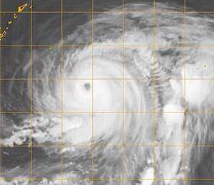
Typhoon Muifa, east-southeast of
Typhoon Muifa will track over or near
Destructive wind and torrential rain will pose a significant threat to
On Tuesday, satellite imagery showed that the eye of Muifa had pulled to within about 400 miles east-southeast of
The Joint Typhoon Warning Center (JTWC) pegged highest sustained winds at 110 knots [【航】节(=浬/小时),浬,海里] (about 125 mph), or that of a Category 3 hurricane. Storm movement was towards the north-northwest at 8 mph.
Muifa will hook more towards the west on Wednesday, owing to steering effects of high pressure near mainland
Beyond the
Forecast tools available to AccuWeather.com show divergent possible paths. One forecast scenario would culminate in landfall on
Another possible path would be more northerly with landfall on the


